The Beginnings of Patterson Lakes

Aerial view showing early formation of Patterson Lakes, 1974.
Introduction
The creation of the suburb of Patterson Lakes is a remarkable story and well worth recording. Few people could imagine that anything good could be achieved from the low-lying and partly flood prone land adjacent to the Patterson River. Certainly in the late 1960's and early 1970's, there were many sceptics in the local Carrum area.
The suburb owes its existence to a group of Victorian Civil Engineers and in particular, to Donald Cameron, whose vision and skill enabled the problems of the land to be overcome.
The Concept
The development of residential areas adjacent to canals and waterways had been carried out successfully in many places. In Australia, the canal developments in Queensland's Gold Coast and at Sylvania Waters in New South Wales, had long proved how popular they were for those who liked to live on the water. No-one had attempted to do this in Victoria. When Donald Cameron looked closely at the land adjoining the Patterson River, he saw the possibility of an exciting development. If it proved to be feasible and practicable, it would give home owners’ access to Port Phillip Bay from their "back door".

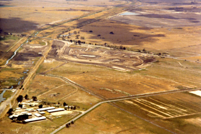
Aerial view of the future site of the Patterson Lakes Project, 1939.
It was clear that any new community should be carefully planned and should offer a range of life styles. Not all owners might like to live on canals or enjoy power boating. The idea developed that some non-tidal or "quiet" lakes would allow sailing and swimming. This concept was misunderstood by some who expected to see canals for power boating in the early stages.
The Land
A large part of the area to the east of Carrum had flooded in the 1930's and 1950's, but to the engineers investigating the land, the important issues were why this occurred and how it could be prevented from occurring again. A common misconception was that the area was all swamp and mud. Extensive drilling found that only a surface layer of peat-like material was unsuitable. Underneath this layer was fine dense sand. The engineers realised that once the unsuitable material was removed (and used to strengthen levee banks and create landscaped areas and reserves) they would then be able to excavate to form lakes and canals, and use the excavated sand in forming residential sites. By using this fine, dense, carefully compacted sand, all the proposed residential sites would be brought to a level above that required by the authorities.
Aerial view of development. Mornington Peninsula Freeway and Thompson Road, 1974.
Zoning and Local Authorities
There was a complex situation with the controlling authorities. Approximately two thirds of the area was within the City of Springvale and one third within the City of Chelsea. The Melbourne & Metropolitan Board of Works was responsible not only for water supply and sewerage but was also the planning authority. The Dandenong Valley Authority was the responsible body for main drainage and the Patterson River itself. A number of other authorities and organisations also required liaison and information in the preliminary stages of the development. [1] (Many changes have occurred since the 1970's, with the City of Kingston now having responsibility for the area and Melbourne Water taking over the MMBW and the D.V.A.)
The majority of the land was zoned rural and to obtain rezoning for residential purposes proved to be a difficult task. In terms of overall planning principles, there seemed to be no sound objection to rezoning, particularly since housing at Chelsea Heights had been allowed to extend eastward to Wells Road some years earlier. It was necessary to present to the relevant authorities a very detailed engineering proposal, to prove that the Patterson Lakes Project was feasible and completely safe.
Planning Matters
The connection of McLeod Road with Thompsons Road was an essential part of the new road layout. It was necessary to "lift" McLeod Road with a bridge structure, to enable boats to gain access from new canals to the River and the Bay. The Mornington Peninsula Freeway was being planned by the Country Roads Board (later to become Vic Roads) and they compulsorily acquired a large portion of the developer's land for the proposed interchange at Thompsons Road. This affected the planning of the area in a substantial manner.
Central sites were planned for a shopping centre and for a marina which would have a second access to the river via flood gates. Sites for housing and apartments overlooking the marina and the river were identified. Sites for a primary school and for community facilities were also incorporated into the overall plan. Also the project was "different", in that more than a hundred non-lake, residential sites were created to further the concept of a new community having a mix of socio-economic groups.
Covenants were placed on titles for the lake and canal allotments to ensure preservation of water views and prevent inappropriate development too close to the waters edge. This ensured that a high standard of development was maintained in the early stages. A plant nursery was established and for years, all new residents were given free native plants and trees to be sure that a true Australian landscape was achieved. In more recent times, control of unsuitable development has been managed by the City of Kingston through planning schemes

Houses fronting onto lake with native plants.
Environmental Issues and Delays
To create a community with strong environmental and aesthetic features by utilising the drainage system (i.e. lakes and waterways) was an imaginative concept. Once proved successful at Patterson Lakes, other residential estates in Victoria adopted the concept and included lakes in their planning.
When Patterson Lakes was first proposed, concern was expressed that the swamp at Carrum was valuable for migratory wading birds. Investigations by different groups eventually established certain facts;
1. that only approximately 50 acres near McLeod Road was of value for wading birds;
2. that this land was privately owned;
3. that far larger wetlands were used by the birds at Edithvale and Seaford (remnants of the original Carrum Swamp), and
4. that these two areas were on Government-owned land and secure for wetlands purposes.
Despite some emotional articles in the press on this issue, it was clear that the Lakes Project would not deprive birds of permanent wetlands. [2] In fact, in later years residents of the "quiet lakes" frequently enjoyed the visits of sand pipers, dotterels, swans and pelicans on the sandy lake shores. In other respects, the proposed development obtained support from the authorities who recognised the environmental benefits it would bring to the area. [3]
Some of the objections raised seemed to be based on the idea that because part of this land at the rear of Carrum had been subject to flooding on previous occasions, no development should be allowed at that time. Considerable delay was caused whilst detailed engineering solutions were presented to answer these concerns. Many doubted that anyone could make a new suburb out of land with a drainage problem but looking at Patterson Lakes in 2008, it is clear that the developers have done this successfully.
Another frustrating and more serious delay to the Project was caused by the Melbourne & Metropolitan Board of Works and its chairman at the time. The application to rezone the land to "Residential" was refused for more than 15 months, despite strong recommendations from the local Councils, no objection from the Board's own planning department and support from local parliamentarians. Not widely recognised is the fact that this delay forced the developers to commence residential sales during a depressed or down-turned market.
Drainage Details
Drainage of the areas adjacent to the River was poor or non-existent and the reasons for this and the methods of overcoming this situation required the application of a considerable amount of technical expertise. The detailed drainage investigations by independent engineers and the Dandenong Valley Authority resulted in many reports consisting of numerous pages.

Patterson River in Flood, 1978.
Put simply the river was the outfall to the sea for the stormwater run-off from a huge upstream catchment. The Dandenong and Eumemmering Creeks directed flows to the Patterson and Mordialloc outlets. As time passed, increased development upstream resulted in greater flows and the authorities, mainly the D.V.A., were frequently confronted with flood flows after storms. On occasions, storm water overtopped the levee banks on each side of each outlet. Over the years, these levee banks were strengthened and increased in height to contain flood flows. Eventually, the D.V.A. was confident that their increased and strengthened levee banks provided a high degree of safety for adjoining land and for the low lying areas of existing housing at Carrum. [4]
Engineers then studied tidal records and determined that the fluctuating levels of high and low tide would be acceptable if the proposed canal system were connected with the Patterson River. Only during extreme flood conditions would the river level reach unacceptable heights. To deal with these occasions, infrequent though they might be, engineers designed a set of flood gates to be built through the levee bank of the river. The gates would remain open to allow boat traffic to pass from the canals to the river and Port Phillip Bay. As design details were finalised, it was decided that a duplicate set of gates should be built as a safeguard against a fault developing with the first pair of gates at a critical time. This set of double flood gates was sometimes referred to, incorrectly, as "lock-gates". The gates would provide complete safety from river flood waters affecting the proposed canals. Engineers calculated that they would be open for boat access 99% of the time, as flood conditions could be expected on very few occasions.
Two further drainage matters are of interest. Creating lakes and canals with water levels about 4' (1.2m) lower than the floor level of any housing provided a huge storage capacity for stormwater. The developers gave an example that a storm over Lake Legana delivering 5" 125mm) of rain in 24 hours would only lift the lake level by 12" (300mm) and by even less in the tidal canals. Notwithstanding this large factor of safety, pumping stations were designed to give the option of moving stormwater to either the Patterson River or the Eel Race Drain. It is common knowledge that water quality in Kananook Creek has improved since occasional pumping of water has been carried out from the Southern Tidal canals of Patterson Lakes into Eel Race Drain.

Lake Legana being formed. Note Peninsula Freeway and Patterson River, 1978.
Water Quality
Expert consultants in a number of disciplines were engaged to ensure that the first "quiet" lakes were not only attractive and aesthetically pleasing, but also that water quality was kept high. To provide options for renewal water, a deep bore was installed, and as a back-up system, a pipeline from the beach front at Carrum was installed to bring sea water to the lakes, if it was ever required. For many years following the completion of Lake Legana in 1974, regular scientific tests of the water confirmed its very high quality (e.g. high dissolved oxygen, nil-ecoli, etc.). In fact, the water in the non-tidal lakes has continued to meet the standard for body contact recreation (i.e. swimming) and the Developers answered the sceptics' doubts about water quality in the best possible way. Some 33 years after Lake Legana was filled, people are still enjoying swimming and sailing and recreation around sandy beaches. A natural eco-system has developed in the lake, with weed growth and fish needing occasional attention. From time to time algael growth has occurred but no chemicals have ever been added. A very active Patterson Lakes Advisory Committee works with Melbourne Water concerning on-going maintenance of the lakes. However, there is no doubt that the developers "quiet lake" concept has been a success. Needless to say, the seawater pipeline was never used and was abandoned.
Eventually the developers tackled the huge task of excavating material from the bed of the river. The removal of thousands of cubic metres of silt and mud from within the levee banks, allowed sea water to flow right back to Wells Road. The resultant wide expanse of tidal water became an outstanding feature of the whole of the Patterson Lakes project. It is worth noting that when the developers completed the river work and proved how feasible it was, Government authorities carried out similar improvements within the river upstream of Wells Road. Although not tidal, this new section of waterway became the National Water Sports Centre.
Community Development
The developers put a lot of effort into helping new residents settle in. Not only did they donate one of the "old" houses in Legana Court for community purposes, but they also constructed two tennis courts for residents to use. Later in the project the developers donated land on the southern side of Thompsons Road, opposite the shopping centre, for a community centre. A fine modern building was later constructed by the Springvale Council and became a focus for many resident activities and in particular, by the primary school for their assemblies and functions.

Aerial view of Patterson Lakes showing Lake Illawong, Thompson Road, Mornington Peninsula Freeway, Lake View Shopping Centre and housing, Mariners Island, Admirals’ Quay and Floodgate, 1978.
Before any residents association was formed, a group of residents decided to express their Christian faith by serving the new community. They felt that it was not necessary for churches to try and establish in the area, so they formed the Community Life Centre, a loosely structured interdenominational group. They commenced the first youth club and began a Sunday school for kids; they began adult discussion groups which met fortnightly and people enjoyed a lot of togetherness as they discussed the problems of the world and the development of their community. Eventually, a once a month church service commenced, first in homes, then in the primary school and later in the new council community building. Ministers from different churches were invited to speak. This group placed great emphasis on caring for people, and were very active with helping the elderly in the retirement villages and apartments which had been created. Christmas carols on the river bank, with the Mordialloc City Band, were popular. The leaders of the Life Centre group were respected and appreciated as they helped those who were ill or bereaved. Their work provided a good basis for the new community. It was a rare but commendable exercise in ecumenical co-operation and practical Christianity.
The Developer
The Victorian engineers who initiated the Lakes Project formed the Gladesville Group of Companies and enabled local investors to share in the subdivisional process. These included a wide range of "small" shareholders and professional people who were excited by the concept. In fact, there was no large or well-established company involved with this Gladesville Group. Merchant Builders, A.V. Jennings and other builders only purchased allotments and built houses as the development progressed.
Finance for the project was arranged with a subsidiary of the CBC of Sydney Bank. Day to day management of the project was carried out by Gladesville Management Services and key personnel were Donald Cameron, John Corp, John Gooden and Bruce Walker (as Finance Director). Appointed as Executive Director was Barry Arnold who joined the Company after more than 20 years local government service with the Cities of Sandringham, Essendon and Dandenong. [5]

Rupert Hamer, Premier of Victoria, speaks with young children at the Official Opening of the Lakes Project. Donald Cameron to the right.
The City Engineer of Springvale, Mr Roy Boyd, and the Chief Engineer of the Dandenong Valley Authority, Mr John Mann, gave positive and professional encouragement to the developers. There were a number of consultants who were critical to the success of the project, contributing their expertise to the creation of this new suburb. [6] In addition there were many other individuals who worked tirelessly for the project - sales managers, contract supervisors, landscape designers and arborists, accountants and other office staff.
A Bitter-Sweet Final Chapter
Despite the developers having expert financial advice and having made careful cash flow predictions, two things made life difficult for them. One was the high front-end or initial capital cost involved in bringing mains sewerage, water supply and underground electricity supply, pumping stations and flood gates, etc., before subdivisional sales could take place. The second was the unreasonable delay inflicted on them by the Melbourne Metropolitan Board of Works which deferred re-zoning and led to marketing of properties during a depressed economy period. Sales were slower than anticipated and as each year went by and more stages of development were constructed, the developer's management company struggled with the ever-increasing interest charges on their borrowings. Patterson Lakes was taking shape and looking good but income never quite exceeded expenditure.

Aerial view of Patterson Lakes – Showing Iluka Island, Lake Legana, and Mornington Peninsula Freeway, 1978.
Unfortunately, the finance company decided not to wait for the final stages of the project to bring in the expected profit. They withdrew their support, and in effect, invited the developer (the Gladesville Group of Companies) to hand over control to the finance company. They apparently appreciated the outstanding work done by the developers but believed they could finish the project's later stages more quickly and more economically than Gladesville. Shareholders in the Gladesville Companies (and there were many local people) were offered only 10c in $1 for their shares. This must have left a bitter taste in their mouths, after creating the start of a very attractive suburb and seeing the final return only a few more years ahead! Subsequently, sections of the as-yet undeveloped balance of the land holdings were sold off to other developers. Large areas north of the river were sold for "normal" or non-lake development sites, which had originally been planned for canal type sites.
Whatever the rights and wrongs of this change of control, the community south of the river went ahead and became a thriving residential suburb. Spare a thought for those who did make a "Silk Purse out of a Sow's Ear" - who overcame great difficulties and showed tremendous engineering and planning skills - but lost their investment despite their best efforts. As resident associations, boating groups and elected councillors guide the future of Patterson Lakes, we do well to pay a tribute to the engineers and shareholders of the Gladesville Group. We owe them a vote of thanks, at the very least!

Trucks lined up to take away soil excavated to form lakes in Stage One of the project. The bridge of Mornington Peninsula Freeway in background.
Footnotes
- Authorities contacted included: State Electricity Commission, Country Roads Board, State Rivers & Water Supply Commission, Town and Country Planning Board, Port Phillip Authority, Environmental Protection Authority, Royal Australian Ornithological Union, and Field Naturalists Club of Victoria.
- “Spare a Thought for the Birds” MordiallocChelsea News, April 19, 1972.
- Williams, W. D. & Timms, B. V., Report on Ecological Implications of the Patterson Lakes Project, Monash University, September 1971.; Randall, C., The Herald, September 1973.
- The authority determined that land for any new housing should be at, or above, R.L. 7.0' and that floor levels be at least 1' higher at R.L. 8.0'. The Chief Engineer of the D.V.A., Mr. John Mann, confirmed these levels in a subsequent letter to project consultants dated 17th May, 1974. All the housing sites at Patterson Lakes were created at or above these levels; higher in fact than much of the Carrum area.
- Barry Arnold's experience in the fields of civil design and subdivisional control enabled him to play a leading role in persuading government authorities that the lakes development was feasible and based on sound engineering design. He also found himself addressing many local clubs and organizations to answer questions and concerns about the new project.
- Consultants to the project: Mr. Graeme Shaw of Earle Shaw & Partners Architects and Town Planners; Mr. Ted Ashton of Lumsden & Ashton - Architects and Town Planners; Cameron MacNamara & Partners - Civil Engineers; Caldwell Connell & Associates - Engineers and Environmental Scientists; Golder Moss & Partners - Soils Engineers; A.T. Cocks & Associates - Valuers & Property Consultants; Mr. John Heywood of H.R. Hill & Co. - Agent & Valuer; Mr. Laurie Kerr - International Public Relations; Mr. Ron Withers of Withers Constructions Civil Contractors
- John Heywood, Estate Agent with H R Hill & Co, Mordialloc. "In the late 60’s and early 70’s I was marketing for a group of businessmen in the Braeside-Mordialloc industrial area. I was asked to look into the possibility of acquiring land on either side of Patterson River – Chelsea Heights to Eel Race Drain. If this came to fruition a new suburb, later to be called Patterson Lakes was in the making. The first waterways, quiet lakes and canals to be built in Victoria. This was a very delicate operation, first asking the farmers along Wells Road and surrounds for their thoughts and expectations for such a scheme. All had to agree to make it a success. Fortunately I was in the position of knowing a good 50% of the land owners through living and working in the area and some having association with my father years prior. I was able to keep them informed on progress, gaining trust and loyalty, whereby the land owner sold the land at its zoned price (farmland) in the hope in the foreseeable future re-zoning to residential and then further incentives paid from the purchases, would enable the dream of a lakes project to eventuate. Over the next two plus years many obstacles had to be overcome, i.e., planning, councils, MMBW, DVA and the like together with many objections. Eventually, with the trust of the landowners and the cooperation of the DVA and Springvale Council, all the land required for the Gladesville Group to start building Patterson Lakes was acquired."
