Changing Street Names in Chelsea
Licensed surveyors engaged by the Shire of Dandenong in the years 1911 to 1916 prepared two large files of subdivision maps of the local Chelsea district. On severance of the district from Dandenong in 1920, these files passed to the Borough of Carrum and were subsequently held by the City of Chelsea.
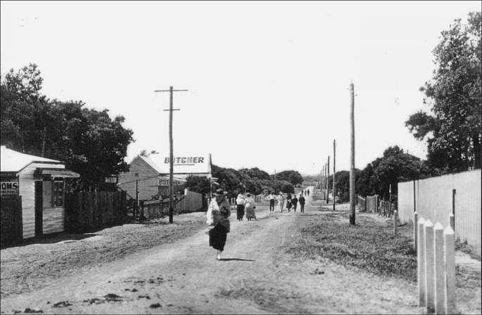
Street in Chelsea c1916. Courtesy of Chelsea Historical Society.
Several subdivisions did not eventuate as either the Borough of Carrum or later the City of Chelsea acquired the tract of land for recreational or council purposes. Examples are Victory Park, Chelsea; Edithvale Reserve, Edithvale; Council depot, Swanpool Avenue; and Council Depot, Chelsea Road.
The area along Bath Street between The Strand and Swansea Road and the beach, was subdivided without provision for Camp Street, with all beach front properties being accessed from the foreshore.
A subdivision was originally planned south of The Glade and was to have street names as King Street, Queen Street and Centre Way.
A road or promenade was planned along the south side of the Patterson River bank to be called Mona Avenue, it did not eventuate, possibly due to the raising of the height of the river banks against the risk of flooding.
Several changes of early street names were made by the Borough of Carrum probably to overcome duplication.
Monica Avenue was originally The Retreat
Bowman Street was originally William Street
Scotch Parade was originally Douglas Parade
Stayner Street was originally Field Aveue
Randall Street was originally Stanley Street
Baker Street was originally Morey Avenue
Haldane Street was originally Barwon Street
Sixth Ave (Aspendale) was originally Beatty Street
McLeod Road was originally Bridge Street
Fowler St (South End) was originally Centre Road
Groves Street was originally Riley Street
The eastern section of Catherine Avenue, and Blantyre Avenue from Fowler Street were named Wave and Ocean Streets, and Beardsworth Avenue was initially named Foam Street.
While possibly a surveyor’s spelling error, on one drawing Blantyre Avenue was shown as Blancyrie while Wimborne was spelt as Wimbourne.
(The Chelsea and District Historical Society holds these early subdivision maps which have been indexed to enable cross referencing to today’s street locations.)
